Tag Archives: bikepacking

Cowboy Trail Flora and Fauna

I took a lot of photos during our recent trip along the Cowboy Trail in Nebraska, and finally got a couple of subsequent trips completed, so I wanted to share these.

The photos will be shown in the order I captured them, beginning at the western end of the trail in the Valentine area and continuing to the eastern trailhead at Norfolk.

The western end of the trail started in the Sand Hills, which I learned was formed from an ancient desert. The dunes are now mostly covered in vegetation, but still very much visible.

As the trail proceeded east, we noted it ambled through rangeland, then into farmland, and finally into a more populated area.

I could identify some of the species of plants and animals we saw, but there were quite I few I didn’t know.

This photo of a bench beside the trail is typical of of the terrain you’ll see at the west end, near the Niobrara River bridge.

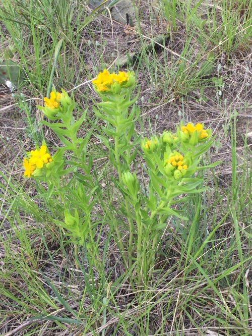
A couple pretty yellow flowers.

A yucca about to bloom. We call these yucca candles.

This pretty flower looks a bit like a sweet pea. Maybe a relative?

Saw this little box turtle sunning itself on the trail.

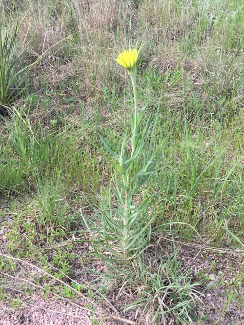
We have lots of these in Oklahoma. Don’t know the name. They look like giant dandelions.

We saw lots of these little garter snakes. This one was on its last legs (so to speak), but it was the only one I was quick enough to photograph.

These kind of look like foxgloves.

A really pretty pink and yellow flower. The petals look a bit papery.

We watched this tiny dung beetle roll its prize across the trail and up a small gravel embankment.

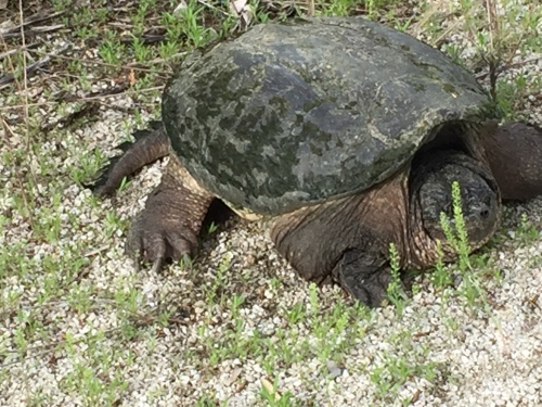
This huge snapping turtle was not impressed with us.

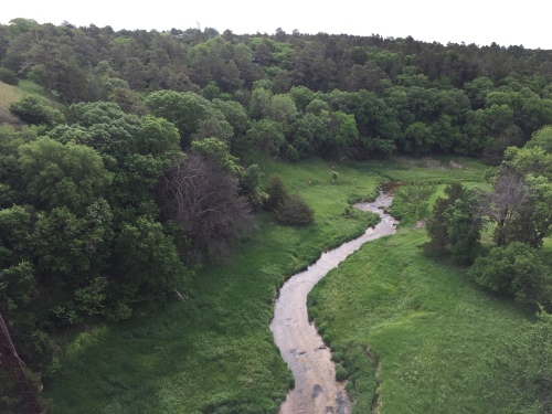
The Long Pine Creek valley was a lovely verdant surprise.

This pasture is typical of rangeland you’ll see all along the trail.

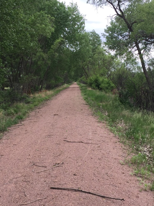
Of course, there are a few tree tunnels, too.

This is soapwort, also called Bouncing Bet. My mom had it growing in her garden when I was a kid. The bee seemed to love it, too.

It looked like some predator made short work of a yellow and black bird. I found these at the campsite in Stuart.

These trees were covered in lovely white flowers. My friend, Candy, identified them: “The tree with the white flowers is Black Locust, a great source of nectar.”

There are lots of possum grapes along the entire route. We kept riding into invisible clouds of a delightful  lovely and sweet scent, and finally determined it was coming from these mounds of possum grapes.

A pretty little five-petaled white flower.

I think this is mullein.

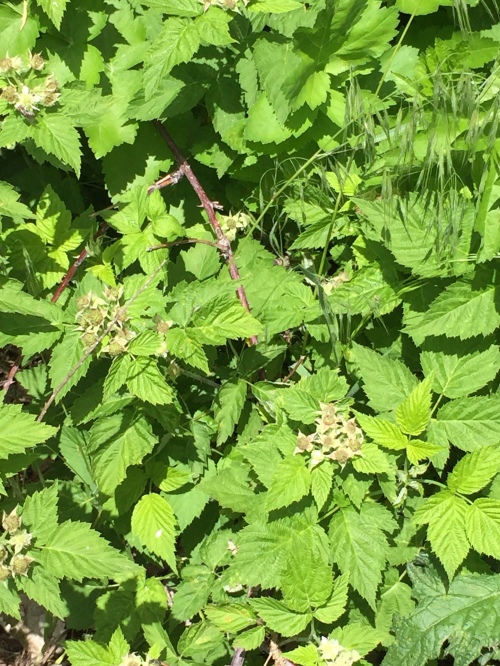
We saw several blackberry patches. Wish they’d have been ripe!

Milkweed.

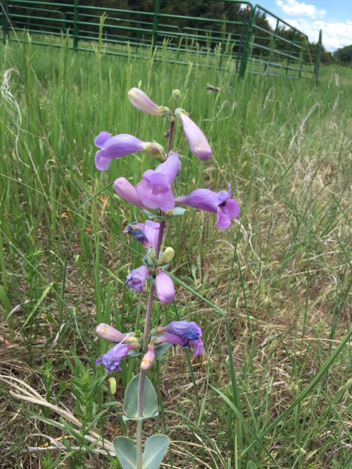
Another foxglove?

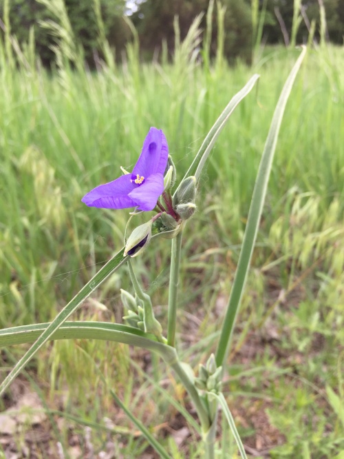
Kind of an unusual purple three-petaled flower.

Pink prairie roses.

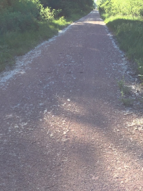
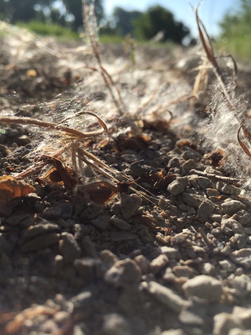
That white stuff lining the sides of the road? Cotton from cottonwood trees. It sticks to sunscreen, lip balm, and chain lube very, very well.

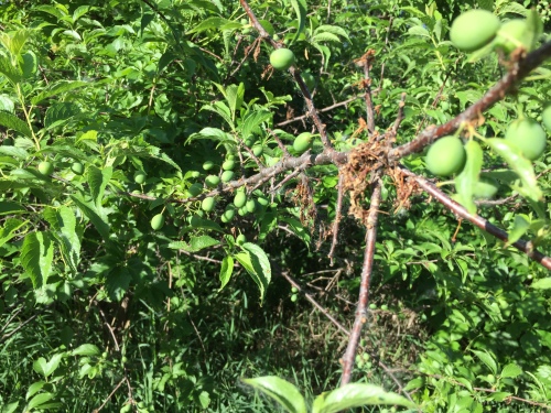
And finally – sand plums! They weren’t quite ripe yet either.

We saw lots and lots of wildlife, but I was way too slow to get a photo of most of it. Besides the turtles and garter snakes, we saw whitetail deer, coyotes, turkey, countless ducks and geese, hawks, and several different kinds of lizards, including horned lizards (we call them ‘horny toads’).

Observations and Notes about the Cowboy Trail

Day 1-Sand Hills overview

A beautiful view of the Sand Hills as we were driving into Valentine, Neb. from the south. Keith climbed to a high vantage point to take this photo.

Some closing observations about the Cowboy Trail:

The Countryside – I became interested in riding the trail after seeing a fabulous video about it. It really highlighted the bridges and scenery, and piqued my interest. The bridges certainly didn’t disappoint, but I think what struck me most about the trail was the landscape. I grew up in western Kansas and Oklahoma, and thought we’d be riding through a similar flat, sparse High Prairie. I was surprised at Nebraska’s verdant rolling ranchland, especially since the area was dotted by many more trees than I expected, and lots of water – rivers, creeks, ponds, and wetlands abound there. And since there is lots of water, there’s also abundant wildlife.

Day 5-train on trail O'Neill

I showed this photo on one of my earlier posts, but am showing it again because it’s typical of the shade you’ll encounter every so often on the trail. You don’t need much for a quick rest/water break anyway!

Shade – Even though there were more trees there than I imagined, shade is sparce. Still, close to the trail you can find a tree or two that will cast enough shade for the occasional short water/rest break. I didn’t find it to be a problem. All of our campsites provided some sort of shade, with the exception of the inn at Ewing, but it was relatively late when we set up camp there, so it wasn’t an issue.

Day 4-tree tunnel

Tree tunnels like this were few and far between, but a welcome sight.

Other riders, or lack thereof – Honestly, I think this was the biggest surprise. We didn’t see another bike on the trail until we’d gone about 190 miles. We did see some tire tracks throughout, but don’t know if that was local traffic or another bikepacker. Until the trail use gains more recognition, I think you will find that you have it mostly to yourself.

Culture – Since the trail makes its way through ranchland, it does live up to its “Cowboy” name. Almost every restaurant or bar we visited, especially on the western half of the trail, had displays of local ranch brands. It was fun to look at the variety of brands, and learn a little history while we were at it.

Another facet of the area that was a bit surprising was the hunting culture. Though considering the abundance of wildlife here, I suppose it makes sense. Hunting and fishing art, advertising, and gear are all easy to spot. We saw lots of fisherfolk, but I don’t think any hunting seasons were open during our trip. That may be something to look into, if you’re planning to visit at other times of the year.

Business hours and availability – this trail meanders through rural Nebraska, so expect some of the small towns to have little or no services. We never had a problem finding water, but you should plan to carry three or four water bottles with you just in case, and replenish at every opportunity.
We found that a number of restaurants, etc. are not open on Sunday, so be aware of that. We carried a couple dehydrated meals and stuff like trail mix and instant oatmeal with us.  It may be advisable to carry some cash with you, as some of the restaurants/pubs do not accept credit cards.

Nebraskans – Almost everywhere we went, we were greeted by friendly people, who were quick to offer advice and suggestions about their area. This is true small town America in its best sense. Lots of people asked questions about our ride or gave us a wave as they passed us. Some expressed appreciation for our effort, while others expressed a kind of fascinated horror, but they were all nice. At no time did we feel in danger.

I think I’d give the highest kudos to the people of Ewing and especially Stuart, where every single person we saw gave us a friendly wave.

Gear – I won’t detail our gear in this post, as I created an earlier post for that just before we set out. (You can find it here:  https://cindysheets.wordpress.com/2018/05/25/bikepacking-gear/) I’ll let you read that one, if you’re interested in the specific gear I used. Over the years, Keith and I have gotten pretty good at whittling down the quantity of gear we use, and focus on the quality instead. I still think that’s good advice. Though I will re-emphasize one error I made when packing for this trip – not bringing my rain suit. Won’t make that error again, no matter the time of year.

lose a nail

Anyone lose a nail?

Trail Hazards – Of course, nothing is all rosy, and this trail is no exception. Even though we gleaned a lot of info from website, it’s always hard to know how our perceptions, abilities, and experience compare to that of other riders who are making comments. It’s prudent to expect to have a different experience than what others report. Having said that, I found much fewer hazards and problems than I expected, based on the comments in the forums.

There are, however, things to be aware of:

Soft sand and unpacked gravel in spots – we were generally not going fast enough that we couldn’t spot these patches before we were in the middle of them. Keep an eye out at road crossings for these spots, too. We are gravel riders, so Keith and I were riding on wider tires that were more suitable for gravel than the bike John was riding.

Day 4-spin out

I was watching some storm clouds instead of where I was headed, and got off into a soft spot. I managed to stay upright, but it got real exciting there for a few seconds. I’m sure it looked hilarious from John and Keith’s viewpoint.

Grass growing on the trail in a few places – the trail was still hard-packed under these grassy areas, so it didn’t slow us down much.

Day 5-grass trail e of Atkinson

This was the thickest grassy overgrowth we encountered on the trail. It was east of Atkinson. It looks dense, but it wasn’t hard to ride through, as the ground was nice and firm.

Goatheads – these appeared much less than we expected. We simply removed the ones our tires picked up so they couldn’t work themselves in. FYI – Goathead plants (we also called them Texas Tacks when I was a kid) grow flat to the ground. They have tiny leaves and small yellow flowers.

Washouts at the edge of bridges – we only saw a couple of these. One was at the west end of the Niobrara Bridge near Valentine, and the other was at one of the very small wooden bridges further down the trail. Again, we weren’t going fast enough that we couldn’t easily see them.

Holes – the entire trail is interspersed with these weird holes. They look very much like some kind of animal dug them. Very strange, as the soil next to the trail would seem to be much easier digging. Some of the holes were pretty large – up to 10 inches or so across! Not something you’d want to hit. We couldn’t figure out what kind of animal was digging them, but our best guesses were badgers or marmots (we did see one of those). While there are a lot of the holes, they are pretty easy to avoid.

varmint hole

One of the varmint holes that we dodged the entire route. I tried to give an indication of size in this photo by putting my tire next to it. Many of these holes had little piles of excavated dirt alongside them, though this one doesn’t. However, you can kind of see claw marks at the lower left edge of the photo.

Washboard – we rode through a few places on the trail that had a washboard-like surface. This happens on all gravel roads, so I suppose it is to be expected at times. Very unpleasant to ride over those spots, as it feels at times as if your teeth will come loose. Just keep an eye out.

Sticks – there aren’t a huge number of trees on the route (see Shade info above), but when you pass by a clump of trees, keep your eyes out for sticks and related debris on the trail.

trail gate

One of the trail gates at every road and path crossing. The signs forbid motorized vehicles and cattle, but those rules seem to be commonly disregarded. In fact, it’s very common to see a path worn by vehicles around the sides of many of these gates.

Motorized vehicles – the trail is closed to motorized vehicles, but it appears that rule is commonly disregarded. Toward the western end, we ran into a guy on a huge tractor pulling an implement on the trail. He courteously got completely off the trail to allow us to ride by. We also saw a guy on a four-wheeler zipping down the trail. We saw all kinds of tire tracks the entire length of the trail. They were not a problem for the most part.

tire tracks

We rode the entire length of the trail, and noted tire tracks on every inch of it. Not entirely sure if the tracks were caused by local traffic or by trail maintenance people. For the most part, the tracks did not cause us problems.

Cow tracks – oddly, this was the biggest issue with the quality of the trail surface. It looks as though cattle were either driven, or got out onto the trail, at a recent time when the trail was soft. As a result, the cow tracks later hardened into bumps that are pretty unpleasant to navigate on a bike. Luckily, there were only around five or six spots like this on the trail, and we quickly learned to keep an eye out for them. I think the problem could easily be remedied if those spots were graded.

I asked John for his thoughts about our ride, and here are his reflections: “Use wide tires. Trail surface was generally good. Small towns were accommodating and people were very friendly. Nice scenery. Not spectacular like mountain states, but pretty and peaceful. Need better info on services in small towns.”

Keith’s reflections:  “The western half was nothing like I expected. The ancient dunes were unusual and had a unique beauty, especially when combined with the many lakes and streams.”

Cowboy Trail – Day 7 – Early Ride to the Eastern Trailhead

Friday, June 1 – Tilden to Norfolk (23.9 miles)

Day 7-Sunrise Campground Tilden

Keith got another nice sunrise shot – this time at the Sunrise Campground in Tilden, NE.

The weather forecast for today called for a brisk headwind, so we decided to get up early and head out in hopes of getting to Norfolk before the wind got going too much. This was a very, very good decision! Not only did we enjoy calm winds, the temperature wasn’t yet too high at this time of day.

We easily sailed east with a few short rest/water stops along the way.

Day 7-Bridge w of Norfolk

The bridge just west of Norfolk is a bit wider than most bridges on the trail.

Just west of Norfolk, we stopped to enjoy the view at the bridge over the Elkhorn River, and finally ran into the first cyclists we saw the entire trip! We enjoyed talking and sharing notes with a couple from Georgia, Sherry & Ardie Olson, who planned to set out on their tandem bike westbound the following day. Coincidentally, two other bikepackers rode by headed west while we were talking with the Olsons.

Day 7-Sherry & Ardie Olson

Ardie & Sherry Olson of Georgia were the first cyclists we ran into on the trail. Amazing, considering we were only a few miles from the eastern end. We enjoyed talking with them and sharing notes.

Day 7-you are here

They left off the “You Are Here” icon on this information kiosk map at the bridge west of Norfolk.

About the time we decided to proceed on into Norfolk, we noted the headwind start to pick up. We were very pleased we decided to start early! (Keith and John find it hilarious that I will admit to that, as I am NOT a morning person.)

The trail turns from gravel to pavement a couple miles west of Norfolk, so the ride in to the trailhead at Ta-Ha-Zouka Park was pretty easy. We stopped at the trailhead sign and a young man there agreed to take some photos of us next to the sign.

Day 7-Norfolk trailhead

Cowboy Trail eastern trailhead, located at Ta-Ha-Zouka Park in Norfolk, Neb.

We hopped on the sidewalk that ran along busy Hwy 81 and headed north into Norfolk, where we grabbed lunch at Perkins Family Restaurant, then went to the New Victorian Inn, where John obtained a room.

We had investigated several ways to manage transport back to Valentine to get our van. Had we had more people along, we may have opted for North Fork Outfitting’s shuttle service, but the cost was a little steep for only three people. Instead, Keith and I rented a car for around $70, left the bikes at the hotel with John, and headed to Valentine. This worked out very well for us. We again spent the night at the Trade Winds Motel, then hit the road in the morning, getting back to Norfolk around noon.

Day 7-loaded van

Van is loaded and ready to roll south.

We loaded the bikes and gear, grabbed an awesome lunch at Whiskey Creek Grill (make sure you get a peach cobbler – delicious!), and headed south.

Day 7-peach cobbler

The peach cobbler at Whiskey Creek Grill. Just do it.

The Dirty Kanza gravel bike races were that weekend in Emporia, Kansas, and since we had quite a few friends participating in the races, we decided to detour through there to cheer them on. Since this blog post is about the Cowboy Trail, I won’t expound on Dirty Kanza, but I will say if you are at all interested in gravel biking you would enjoy the high energy atmosphere at DK. It is amazing! Here’s a link to the event: https://dirtykanza.com

Cowboy Trail – Day 4 – Tailwinds and Beautiful Country

Tuesday, May 29 – Ainsworth to Stuart (41.3 miles)

Tuesday morning was bright and sunny, so we had breakfast at the hotel and hit the trail. The trail access is just south of the East City Park, which looked like a nice place to camp. (The road between the RV park and the south ball field leads to the trail.) When I was doing research for the trip, I called the Ainsworth city offices and was told the campground has restrooms and electricity, but no showers. However, showers are available at the city office locker rooms, which are located across the highway from the Red & White Grocery Store on Hwy 20. Tent camping is $7. I was told the best sites are next to the tennis courts. I’d recommend calling the city office to ask about the showers, if you plan to camp there. We’d have almost certainly camped there, if it hadn’t been storming.

We had a nice tailwind this day, so we made up some miles, despite temperatures in the 90s. Here’s Keith’s video of the beautiful start on the trail out of Ainsworth:

The trail surface still consisted of red granite-like pebbles that appeared to have been raked, but about three miles east of Ainsworth, the trail surface changed from the red to a white gravel. It was still a nice, firm surface, but it contained some grass patches. No sign of goatheads.

Day 4- Long Pine selfie

Long Pine Bridge selfie of Suzanne Sugarbaker (my Fargo) and me. This is looking east toward town.

We came across another lovely long and tall bridge on the west edge of Long Pine. It crossed a little creek in a beautiful little valley. I wasn’t aware of this bridge, so its appearance was a fine surprise. A couple of huge turkeys crossed in front of us at the east end of the bridge.

Day 4 Long Pine creek

Long Pine Creek. What a beautiful little valley!

My apologies for the dizzying amateur video above. I guess I was excited.

Day 4-Long Pine Bridge low

Keith got this cool down low pic of the bridge.

Day 4-Long Pine Bridge high

And another view from up high. You can see the town of Long Pine in the distance.

We didn’t stop in Long Pine, but noted what looked like a bunkhouse made from an old depot right along the trail. I think it would be worth checking out, if you want to stop for the night at Long Pine.

The town of Bassett appeared about the time we needed to find a cool spot for a break, so we rode a couple blocks downtown and found the Range Café. It was late morning, and we had a delicious breakfast here. The café is part of a lodge that looks kind of old-timey. I’d love to go back there for an overnight stay. If you have time, drop by to at least see it.

Day 4-Bassett Range Cafe

Breakfast at the Range Cafe in Bassett. Look at that slab of ham!

As we went back to the trail at Bassett, we picked up a few goatheads. We stopped and removed them and didn’t see any more, so proceeded with no trouble.

Twelve miles later, we stopped for a break at the tiny town of Newport. We’d seen reports of the pool hall, so wanted to check it out. It’s located just south of the trail, with a couple of picnic tables under some trees. The pool hall itself appears to have been a weigh station at some point, as you can still see the pad out front and the old scale in the front window. Inside, there’s one pool table, a short bar, and some snacks that are available for purchase on the honor system. Pretty neat little place!

Day 4-bike rest at Newport

The bikes needed a break.

Day 4-Newport pool hall 2

John in front of the Newport Pool Hall.

Day 4-Newport pool hall 1

Keith and me in front of the Newport Pool Hall.

Day 4- Newport Pool Hall inside.jpg

Keith’s shot of inside the Newport Pool Hall.

We rolled into our overnight stop, Stuart, in the afternoon. Some locals directed us to the Stuart City Park, where we set up camp. This park is nicely maintained, and has a dedicated area for tent camping in a lush grassy area adjacent to the small RV park. The shower house is located a hundred yards or so to the north. We found the place very clean and comfortable. The park maintenance woman told us we could move our tents to a covered pavilion area if it started raining again. Thankfully, we ended up not having to do this as the chance of rain diminished throughout the day.

Day 4-unpacking at Stuart

Keith’s shot of me unloading gear at the Stuart City Park campsite.

After setting up camp and getting our showers, we headed over to the Cast Iron Bar & Grill, located on the far southeast corner of town, for supper. We enjoyed a great supper of fish & chips accompanied by some really good Nebraska craft brews.

We went back by the Mini-Mart, located on South Main/Hwy 20 for a pint of Jack, then headed to camp to chill out. There was a Little League baseball game going on, so there were quite a few people at the park, but they all cleared out pretty early and it ended up being a quiet, pleasant night.

Cowboy Trail – Day 3 – Thunderstorms

Monday, May 28 (Memorial Day) – Johnstown to Ainsworth (10.5 miles)

Day 3-drying tent

Trying to dry out my tent before packing it up.

We were very glad for the shelter when the rain started during the night. It continued into the morning while we broke camp. We waited awhile to see if it would let up, but it showed no signs of stopping, so we decided to bite the bullet and head on to Ainsworth.

I must pause here and comment on my gear. I own a good quality Showers Pass rain suit. When packing for this trip, I pulled it out of my closet and thought, “Nah, I won’t need this, and then put it back.” Boy, did I regret that decision this day! Luckily, John had packed several items of waterproof clothing, and he let me borrow his rain jacket. That really saved the day for me! I have little tolerance for getting chilled, and I’d have been in real trouble without that jacket.

As it was, we rode the 10 miles to Ainsworth in the pouring rain, complete with lightning. Not the most fun I’ve had on a bike, but we made it. I wish I could’ve seen more of the countryside in that area, but I was concentrating on keeping my head down so I could see the road in front of me. One thing I did note was the thousands of earthworms that had crawled out on the highway during the deluge.

A note: while we were at the L Bow Room, we asked Ms. Ruth about reports we’d read of goatheads on the trail. She confirmed the stretch between Johnstown and Ainsworth was riddled with goatheads and recommended we hop on the highway for that portion. She said trail maintenance people have been trying to eradicate the burrs, but have not had luck with it.

Honestly, we’d seen enough ride reports about this stretch of trail that we expected we may have to go around it, so it wasn’t a surprise.

We rolled into Ainsworth, got rooms at the Rodeway Inn (the desk clerks were kind enough to allow us to drip all over their lobby), and dried out. We hit the Pizza Hut buffet for lunch, and grabbed a bite for supper at Big John’s Restaurant; both restaurants are right across the highway from the inn.

Day 3-cleaning up bikes

Later in the day the rain stopped, so we cleaned and lubed the bikes.

Cowboy Trail – Day 1 – Long Day on the Road

Cowboy Trail main.jpg

Cowboy Trail 2018

Valentine, NE to Norfolk, NE


This series of blog entries will recap a week-long bikepacking trip on the Cowboy Trail in north central Nebraska. My trail notes will include notes about the ride – terrain, flora and fauna, campsites, restaurants, rest stops, cool stuff, obstacles, some of the people we met, and whatever else comes to mind.

I was traveling with my husband, Keith, and his brother, John. Keith and I elected to ride our gravel bikes; mine is a Salsa Fargo, and his is a Surly ECR. John was riding a Surly Disc Trucker touring bike.

Fargo

Salsa Fargo

ECR

Surly ECR

Disc Trucker

Surly Disc Trucker

Our goal for this trip was to take our time and enjoy the country, not bust it to reach the end as fast as we could. We thought we’d shoot for 30-40 miles a day, but we planned to just roll with it if we felt like doing something else.

At the end of this series of posts (one for each day), you’ll see some general observations and tips. If you have questions, just fire away!


Day 1 – Long Day on the Road

Saturday, May 26 – drive from Oklahoma to Valentine, NE

We chose to ride the trail west to east, mostly because the prevailing winds this time of year would be coming from the west/southwest. For the most part, this proved to be true, so it was a good decision.

It is approximately 620 miles from our home to Valentine, so we knew it would take a full day to drive up there. We reserved rooms at the Trade Winds Motel in Valentine. The Trade Winds, located along Hwy 20 on the south edge of town, is an older-style motel that has been updated, and our rooms were very clean and comfortable. The grounds are well-manicured, and the motel has a nice free breakfast.

There are several hotels in town, but if you plan to stay there it would be best to make reservations in advance because the town seems to be doing a brisk business catering to people who are there to enjoy the Niobrara River and other recreational areas.

D1-Niobrara Bridge.jpg

A view of the Niobrara River Bridge from Hwy 20.


The Trade Winds owners allowed us to leave our van in their overflow lot during the week.

Bikepacking gear

I’ve had many people ask about the gear we use while bikepacking. My husband and I are getting ready to do a week-long ride in Nebraska, so I photographed my gear and what I’ll be bringing. When we got started bikepacking, I found this kind of information very helpful in learning how it all goes.

First – a note about this particular ride. We will be riding the Cowboy Trail, which is a 195-mile route across north central Nebraska. This trail is part of the national Rails to Trails Conservancy, which converts old unused railroad routes into trails for use by hikers and cyclists, and in some areas, horseback riders. If you’re interested in bikepacking, I’d really encourage you to take a ride on one of these trails to get started. Some are paved, but most consist of hard-packed fine gravel, so they are easy to ride. And since they are old railroad beds, they’re also pretty flat. They’re located all over the country, so you’re sure to find one close to your home. Cowboy Trail guide

My first taste of a rail-trail was on the Katy Trail in Missouri, which was a fantastic experience. I used a different bike and gear, but I’ll cover that in another blog post.

This trip, I decided to ride my gravel bike, a Salsa Fargo. I’ve had this bike for a couple years, and really love how comfortable she is to ride. (Her name is Suzanne Sugarbaker.) Since I hadn’t taken her bikepacking before, I had to get a few new pieces of gear to get her ready to haul a load. Here she is before I loaded everything on her. She has an aluminum frame with a carbon fork.
Fargo unloaded

I already had the two feedbags at top left, which I usually use to hold water bottles, the tank bag that’s mounted on the top bar, the saddle bag (mounted under the seat), and the frame bag. I purchased a Salsa Alternator Standard Rear Rack, which you can see mounted. I’ll be putting Ortlieb panniers on it. I also purchased two Salsa Anything Cages, which you can see mounted to the front fork, and will be carrying two Salsa Anything Cage Bags on those.

I’ll now show you each bag and what I’m putting in each one. After I got them packed and on the bike, I did have to move a couple things around to make sure weight was distributed equally. Will try to note those changes below.

RP camp

One rear pannier will carry my camp gear (kind of listed clockwise beginning with the sleeping bag): a Sea to Summit lightweight sleeping bag (its compression bag is the yellow/green and black bag at top right), REI down compactable pillow, sleeping bag liner, towel and washcloth, solar camp light, head light, mini first aid kit, bug spray, liquid camp wash, sleeping bag pad, a couple of clips, TP, sleep socks, and flip flops. I forgot to include a small portable battery in this photo.

My husband, Keith, will be hauling our tent.

I just realized I didn’t note the brand/model of most of this gear, and since it’s already packed, I’ll add that info later.

RP clothes

The other rear pannier will carry my clothes for the week. Clockwise-ish, beginning at the ball cap: Patagonia lightweight khaki pants, t-shirt, and shorts (all for off-bike), midweight jacket (black), windbreaker (yellow), silk long underwear, yellow shopping bag (handy for carrying clothes to and from shower), five pairs socks, shorts and t-shirt to sleep in (grey at center), sleeves (white), riding gloves, Buff, two pair cycling shorts, two short sleeve jerseys. I’m also bringing several pairs of underwear, but you don’t need to see them.

With the exception of the gloves and sleeves, I’m not including the riding clothes I’ll be wearing when we start out. Again, I’ll get info on specific brands for this stuff.

Some other people I ride with don’t carry as much clothing as I do. It’s personal choice. I’m not comfortable if I’m not reasonably clean, so I bring more. I can and have washed clothes on the trail, so there’s always that option. Again, personal preference.

cage food

One of the cage bags will carry food-related items. Clockwise, from top left:  bag of Skratch and Shockblocks, bag of Starbucks Via instant coffee, bag of sweetener packets, a couple packets of instant oatmeal, travel-size packets of HooHa Ride Glide (ended up putting this in the clothing pannier), koozie, spork, pocket knife, collapseable bowl and cup, bandana.

Keith will be carrying our Jetboil camp stove. This is one of our favorite pieces of gear, and I’d absolutely recommend spending the extra money to get one.

We are planning to stop at the many small towns along the route for our meals, so didn’t bring much in the way of food, except the oatmeal (I have better endurance throughout the day if I get something in my stomach before starting a ride). We also each brought one packet of Mountain Home dehydrated food in case we are unable to find a cafe at any given day. I stowed that in my clothing pannier.

Also, you will notice I didn’t skimp on the coffee. Civilized life would cease to exist (at least around me) if I don’t have a couple cups of coffee in the mornings. Besides, it weighs next to nothing. Non-negotiable.

cage toi

I am using the other cage bag to carry my travel-sized toiletries and some trail mix refills. I think I got the little toiletries bag at Walmart, but can’t recall right now. I like it because it’s much sturdier than a ziploc bag to carry toiletries. It’s not a large bag, but it carries all I need.

tank

The tank bag doesn’t hold a lot, but I use it to carry my phone, a small bag of trail mix, and an emergency TP bag. I mix my own trail mix to get the stuff I like. I prefer larger chunks of nuts, such as walnuts, dried apricots and blueberries, and M&Ms, plus a few other things. I like having chocolate in the mix, but learned to use M&Ms or those cocoa powder-covered almonds, or the chocolate ends up melting and you wind up with a mess.

I ended up having to put my small notebook and a pen in my camp pannier.

frame

My frame bag is holding my sunglasses case, sunscreen, a small pack of tissues, my wallet, and a mesh bug net. I also have a compact bike lock in there that I forgot to add to this photo.

chair

I’m carrying my Helinox camp chair on the rear rack. Easy to strap it on using a couple of Roc straps. This chair is another item I think is worth splurging on. It’s very lightweight and much more comfortable than sitting on the ground in the evenings.

feed bags

Top view looking at my Revelate feedbags. I use these to carry water bottles. They have a little bit of insulation, so they do keep the water cool for awhile. On short rides, I usually put my phone in one and a water bottle in the other. They have drawstrings if you want to secure something.

This photo also shows my bike computer, and the other mount is for my headlight. I probably won’t need it on this ride, but I put it and my taillight in one of the panniers.

cage bags front

Just a shot showing the cage bags mounted. I also forgot to mention the bottle cage mounted underneath the frame. You can see it at right side of this photo. I will carry three bottles of water this trip.

front

Here’s a different view of the front of the bike after it was loaded.

tank and frame

A view of the loaded Revelate tank bag and Banjo Brothers frame bag. The feedbags have little mesh compartments (top left) on the side where I usually keep stuff like a tissue and lip balm.

rear

A view of the rear of the bike after it was loaded. You can see how neatly the Ortlieb panniers and my chair sit on that rack. The weight is pretty much equal between the two bags, even though one looks puffier than the other.

A word about Ortlieb panniers … I have this large set and a smaller matching set that fits on the front rack of my touring bike. I also have a matching handlebar bag. So far, I’m very happy with these bags. They are durable, seem to be holding up well, and they seal well. They’re also nice looking. There are less expensive brands out there, but these are doing a great job for me.

I failed to take a photo of the gear I always keep in the saddle bag, which is a spare tube, a patch kit, a folding bike tool, and a tire lever set. I also always carry a mini tire pump, which can be seen mounted to the lower post.

Fargo loaded

And here she is – all loaded. What a beautiful rig!

I have 27.6 pounds of gear, not including the three water bottles. I think that’s a pretty reasonable load. I will again note that I’m lucky to be traveling with my husband, as he’s a stronger rider and can carry our tent and camp stove.

Of course, the load will vary for each person, according to their personal needs or preferences. It doesn’t take long to figure out what items you can ditch, and what items are essential. (Honestly, you don’t need as much of that crap as you think you do.) You will also need to determine your specific ‘extras,’ which aren’t essential, except for your own well-being. My personal must-have items are coffee, a pillow, chair, and baby wipes. Oh, and definitely sunscreen.

Keith gear

Here’s how Keith is organizing his gear. He has basically the same stuff I do, with the addition of the Jetboil, our tent, and a first aid kit. He also threw in a water purification system. I didn’t bring mine because we will be going through towns every 10-15 miles or so on this trail. FYI – he rides a Surly ECR and will be using small rear panniers and cage bags on the front fork.

So that’s it! If you have comments or questions, fire away and I’ll try to answer them. And I will update this info with specific brand/model info for the gear. I just don’t want to unpack everything now.

I hope to make some posts while on the Cowboy Trail, but if we don’t have good internet service, I’ll do it when we return.